每日海域態勢報告Daily Maritime Situation Report
今日重點Today at a Glance
7,694
AIS 船舶AIS vessels
16,147
暗船 (SAR)Dark vessels
1,623
可疑船隻Suspicious
680
極高風險Critical
614
緊貼海纜Near cable
276
可疑旁靠Suspicious STS
暗船比對成效Dark-vessel verification
16,147
SAR 暗偵測SAR dark detections
2,403
固定設施剔除Infra filtered
825
本地 AIS 對上Re-matched
12,919
殘餘暗船Residual dark
20.0%
假暗船剔除率False-dark removed
0
AIS 覆蓋外Outside coverage
2403
12919
GFW 判定為「未匹配 AIS」的 16,147 筆 SAR 偵測,先剔除 2,403 筆風機/平台等固定設施,再以港務局本地 AIS(21,351 艘、推算至 Sentinel-1 過境時刻)重新比對,對上 825 筆假暗船(覆蓋範圍內重比對率 6.0%),剩下 12,919 筆為殘餘暗船;其中 0 筆落在本地 AIS 保留期之外,無法驗證。Of 16,147 SAR detections GFW flagged as AIS-unmatched, 2,403 were removed as fixed infrastructure (wind farms / platforms), then re-matched against local Port Bureau AIS (21,351 vessels, dead-reckoned to the Sentinel-1 overpass instant): 825 turned out to be false dark ships (6.0% re-match rate within coverage), leaving 12,919 residual dark detections — of which 0 fall outside local AIS retention and cannot be verified.
SAR 取證影像SAR chip forensics
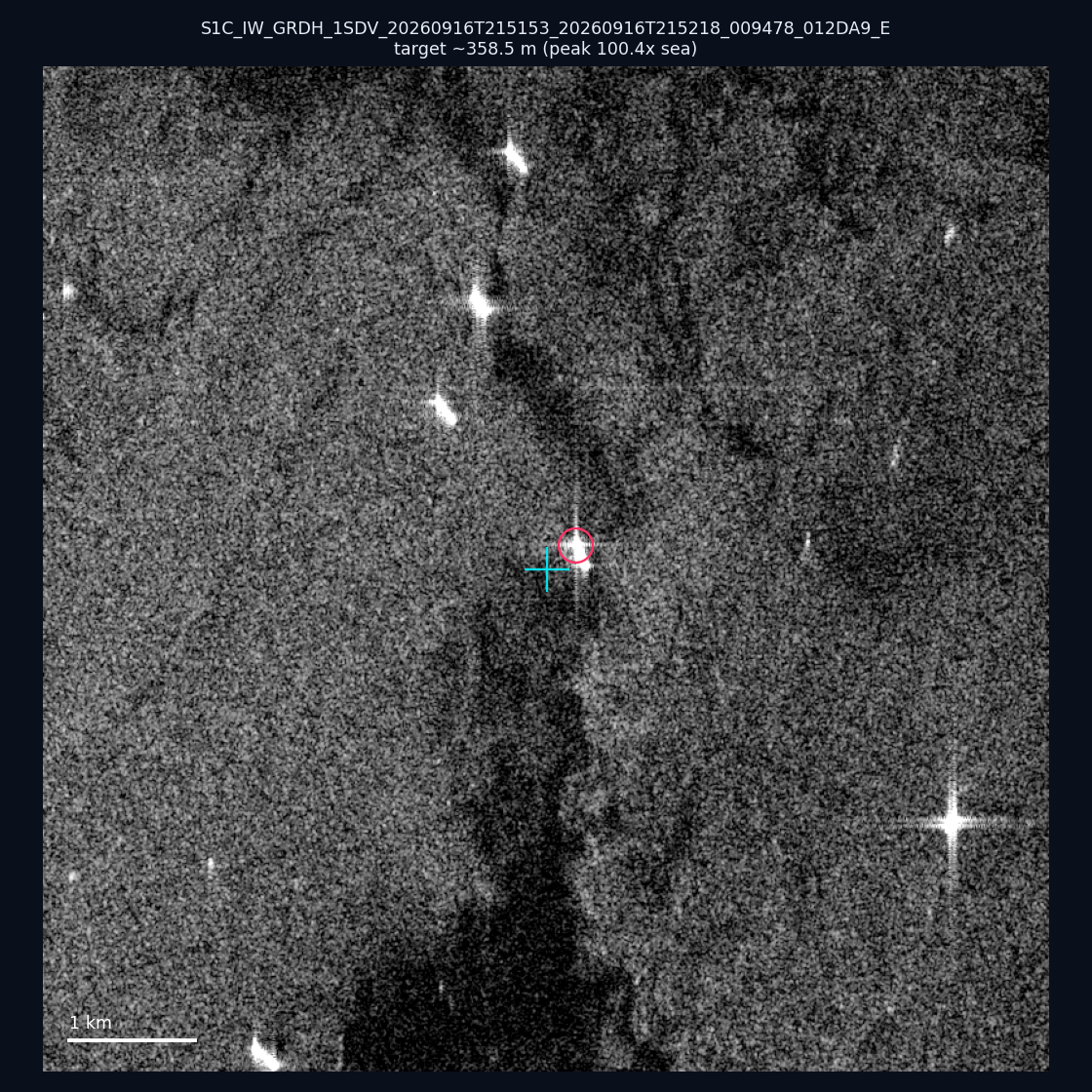
📅 2026-09-16 · 📍 22.56, 120.23 · 🛰️ 21:51 UTC · internal_waters
~358.5 m · 100.4× (252 px)
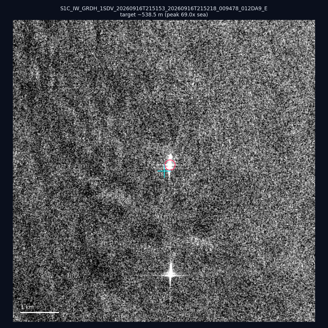
📅 2026-09-16 · 📍 23.41, 119.89 · 🛰️ 21:51 UTC · internal_waters
~538.5 m · 69.0× (321 px)
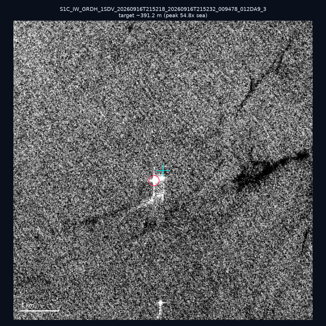
📅 2026-09-16 · 📍 22.19, 120.32 · 🛰️ 21:52 UTC · territorial_sea
~391.2 m · 54.8× (304 px)
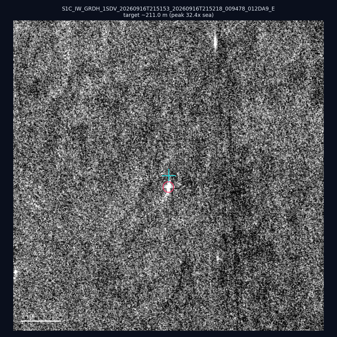
📅 2026-09-16 · 📍 22.55, 119.98 · 🛰️ 21:51 UTC · territorial_sea
~211.0 m · 32.4× (127 px)
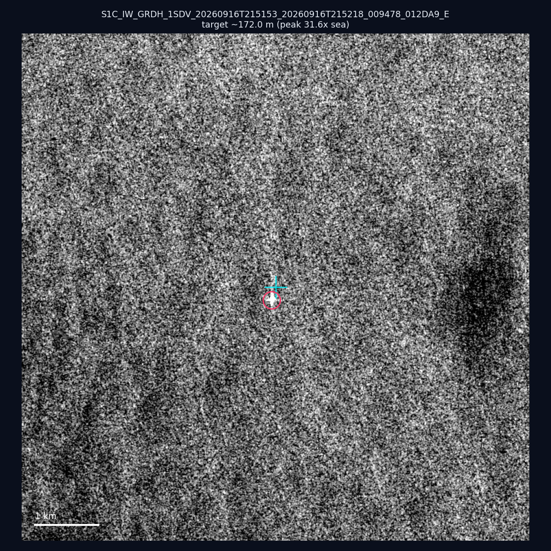
📅 2026-09-16 · 📍 22.63, 119.9 · 🛰️ 21:51 UTC · territorial_sea
~172.0 m · 31.6× (71 px)
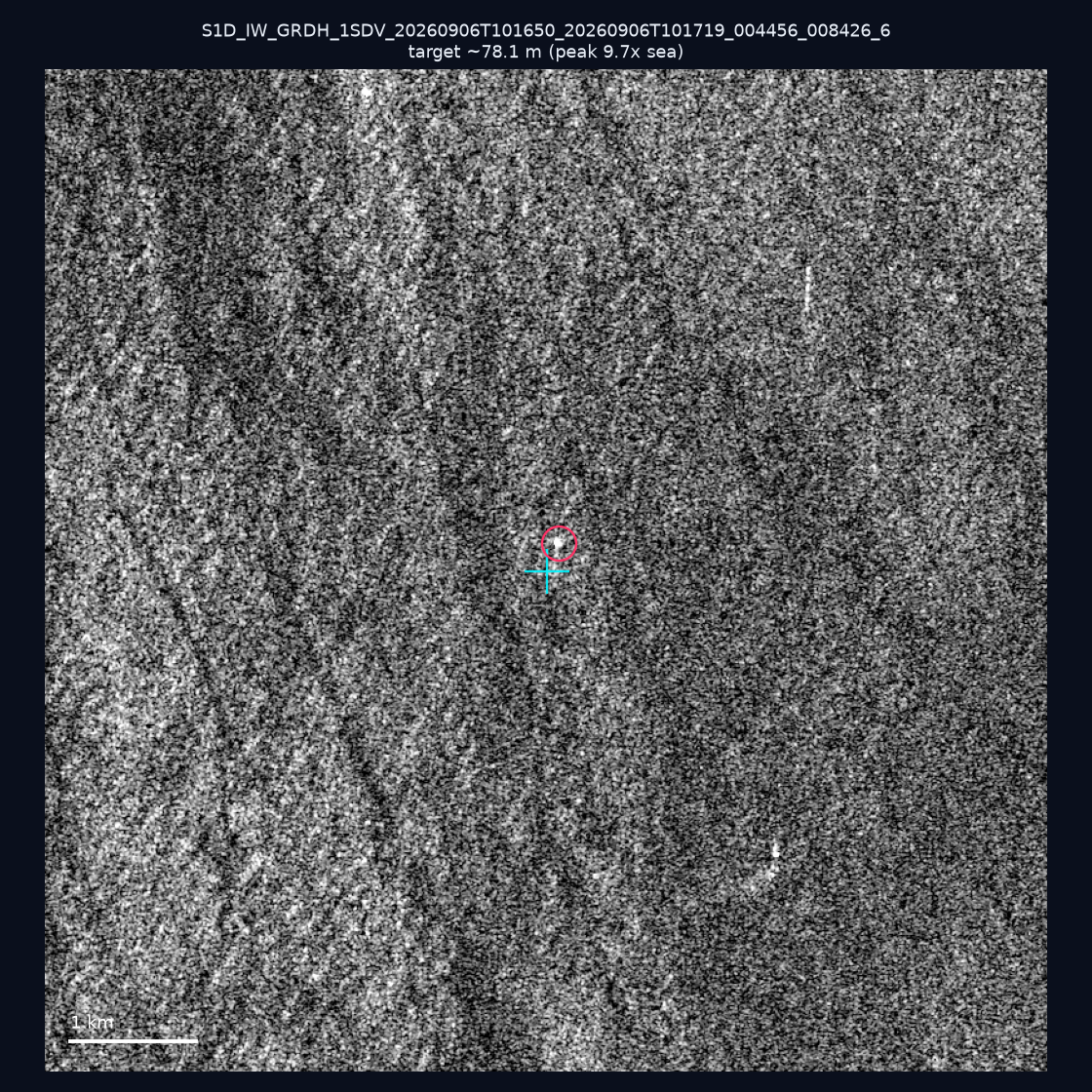
📅 2026-09-06 · 📍 23.21, 118.33 · 🛰️ 10:16 UTC · eez
~78.1 m · 9.7× (21 px)
| 日期Date | 座標Position | 海域Area | 法域Zone | 成像時刻Acquired | 判定Verdict | 估計長度Length | 峰值比Peak |
|---|---|---|---|---|---|---|---|
| 2026-09-16 | 22.63, 119.9 | southwest | territorial_sea | 21:51 | ✅ 確認實體目標Confirmed target | ~172.0 m | 31.6× |
| 2026-09-16 | 22.76, 120.02 | southwest | internal_waters | 21:51 | 🟡 弱目標Weak target | ~588.7 m | 7.9× |
| 2026-09-16 | 23.47, 119.91 | southwest | internal_waters | 21:51 | ⚪ 無目標No target | — | — |
| 2026-09-16 | 22.71, 120.15 | southwest | internal_waters | 21:51 | ⚪ 無目標No target | — | — |
| 2026-09-16 | 22.56, 120.23 | southwest | internal_waters | 21:51 | ✅ 確認實體目標Confirmed target | ~358.5 m | 100.4× |
| 2026-09-16 | 22.55, 119.98 | southwest | territorial_sea | 21:51 | ✅ 確認實體目標Confirmed target | ~211.0 m | 32.4× |
| 2026-09-16 | 23.41, 119.89 | southwest | internal_waters | 21:51 | ✅ 確認實體目標Confirmed target | ~538.5 m | 69.0× |
| 2026-09-16 | 22.68, 120.18 | southwest | internal_waters | 21:51 | ⚪ 無目標No target | — | — |
| 2026-09-16 | 23.12, 119.97 | southwest | internal_waters | 21:51 | 🟡 弱目標Weak target | ~42.4 m | 4.1× |
| 2026-09-16 | 22.78, 120.11 | southwest | internal_waters | 21:51 | ⚪ 無目標No target | — | — |
| 2026-09-16 | 22.46, 120.26 | southwest | internal_waters | 21:51 | ⚪ 無目標No target | — | — |
| 2026-09-16 | 22.19, 120.32 | southwest | territorial_sea | 21:52 | ✅ 確認實體目標Confirmed target | ~391.2 m | 54.8× |
| 2026-09-16 | 24.79, 121.88 | east | internal_waters | 21:51 | ⚪ 無目標No target | — | — |
| 2026-09-16 | 22.52, 119.35 | southwest | eez | 21:52 | ⚪ 無目標No target | — | — |
| 2026-09-16 | 22.78, 120.14 | southwest | internal_waters | 21:51 | ⚪ 無目標No target | — | — |
| 2026-09-16 | 25.26, 121.7 | east | internal_waters | 21:51 | 🟡 弱目標Weak target | ~127.3 m | 9.5× |
| 2026-09-08 | 23.66, 121.58 | east | territorial_sea | 10:00 | 🟡 弱目標Weak target | ~22.4 m | 3.3× |
| 2026-09-06 | 23.21, 118.33 | southwest | eez | 10:16 | 🟡 弱目標Weak target | ~78.1 m | 9.7× |
| 2026-09-04 | 22.21, 121.68 | east | territorial_sea | 21:51 | ⚪ 無目標No target | — | — |
| 2026-09-04 | 25.18, 121.81 | east | internal_waters | 21:51 | ⚪ 無目標No target | — | — |
| 2026-08-28 | 25.37, 123.14 | east | eez | 09:52 | ⚪ 無目標No target | — | — |
| 2026-08-27 | 24.54, 121.99 | east | territorial_sea | 10:00 | ⚪ 無目標No target | — | — |
| 2026-08-25 | 23.32, 117.19 | southwest | eez | 10:16 | 🟡 弱目標Weak target | ~80.6 m | 5.4× |
| 2026-08-25 | 23.5, 117.77 | southwest | eez | 10:16 | ⚪ 無目標No target | — | — |
| 2026-08-23 | 22.48, 121.72 | east | territorial_sea | 21:51 | 🟡 弱目標Weak target | ~67.1 m | 4.7× |
| 2026-08-23 | 23.21, 121.67 | east | territorial_sea | 21:51 | ⚪ 無目標No target | — | — |
| 2026-08-21 | 22.93, 122.43 | east | eez | 09:59 | ⚪ 無目標No target | — | — |
可疑船隻 Top 5Top 5 Suspicious Vessels
| 船舶Vessel | 類型Type | 分數Score | 法域Zone | 海纜Cable |
|---|---|---|---|---|
| SAFCO 457119000 | cargo | 28 | internal_waters | — |
| YING HAI 59 412522610 | cargo | 28 | contiguous_zone | — |
| HUI DE 413332760 | cargo | 28 | territorial_sea | ≤1km |
| DIANA 667001430 | tanker | 27 | internal_waters | — |
| CHERRY 168 667001298 | tanker | 27 | contiguous_zone | — |
資料來源與限制:AIS 可能因轉發延遲或船舶走暗而不完整;SAR 偵測代表雷達可見目標,不必然代表違法;可疑分數為風險排序,並非法律認定。本報告由公開資料自動產生。
Sources & limits: AIS may be incomplete due to relay delay or vessels going dark; a SAR detection is a radar-visible target, not proof of illegality; the suspicious score is a risk ranking, not a legal finding. This report is auto-generated from public data.